
The best chance of storms will be tonight after sunset, progressing from west to east across the area.
Interstate 95 and Beltway area: 8 p.m. and midnight.Note that brief, gusty showers are possible before the mainline of showers and storms late this evening.Midnight west of the Beltway, around 1 a.m. around the Beltway, and 2 a.m. near the Chesapeake Bay.Small chance of: Brief tornado, small hail, destructive winds , lightning, flooding.Discussion
In the upper levels, a potent trough of low pressure is approaching the Eastern Seaboard. The uplift of air is expected to intensify across the D.C. area as the trough amplifies. With the influx of southern moisture and rising air, waves of showers will develop and transit our region through the afternoon and evening.Our concern shifts to the early evening, as the front nears and a pocket of unstable air develops just along it.
While the instability may be somewhat lacking through a deep layer, the low-level wind fields are exceptionally strong and ideally configured such that any deeper cells may achieve rotation. A look at these very strong winds about a mile above the surface is shown below; note that they are in the range of 70+ mph.
The two images below present radar snapshots as simulated by various forecast models. In the first, the high resolution NAM model suggests a squall line, with embedded strong to severe cells, will pass through the area between 10 p.m. and 1 a.m.
Brasil Últimas Notícias, Brasil Manchetes
Similar News:Você também pode ler notícias semelhantes a esta que coletamos de outras fontes de notícias.
 Strong To Severe Storms Likely Wednesday Night Into Thursday Morning - Alabama NewsStrong to severe storms are likely Wednesday night into early Thursday morning! All modes of severe storms will be possible with this event. We expect damaging winds up to 80 mph along with a few tornadoes. Non-thunderstorm winds will be rather gusty at 30 to 40 mph throughout the day Wednesday. The storms will enter west Alabama around 6pm and...
Consulte Mais informação »
D.C.-area forecast: Milder by this afternoon; storms possible late ThursdayWarmer highs tomorrow in the 70s could help trigger a line of strong to severe storms, but confidence is low for now.
Consulte Mais informação »
Brief Wintry Mix Likely Today, Then Potentially Severe Storms Threaten on ThursdayThe tri-state's weather roller coaster continues its wild run the next two days, which will feature everything from possible snow to powerful thunderstorms — with temperatures going from below freezing to near 70 in that span
Consulte Mais informação »
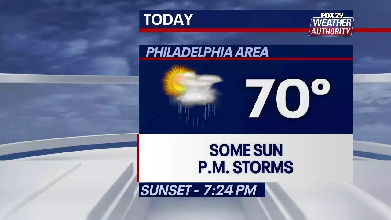 Strong storms, intense winds to impact Delaware Valley late ThursdayThursday will be warmer than the beginning of the week, but a cold front moving through later in the day will bring showers and storms.
Consulte Mais informação »
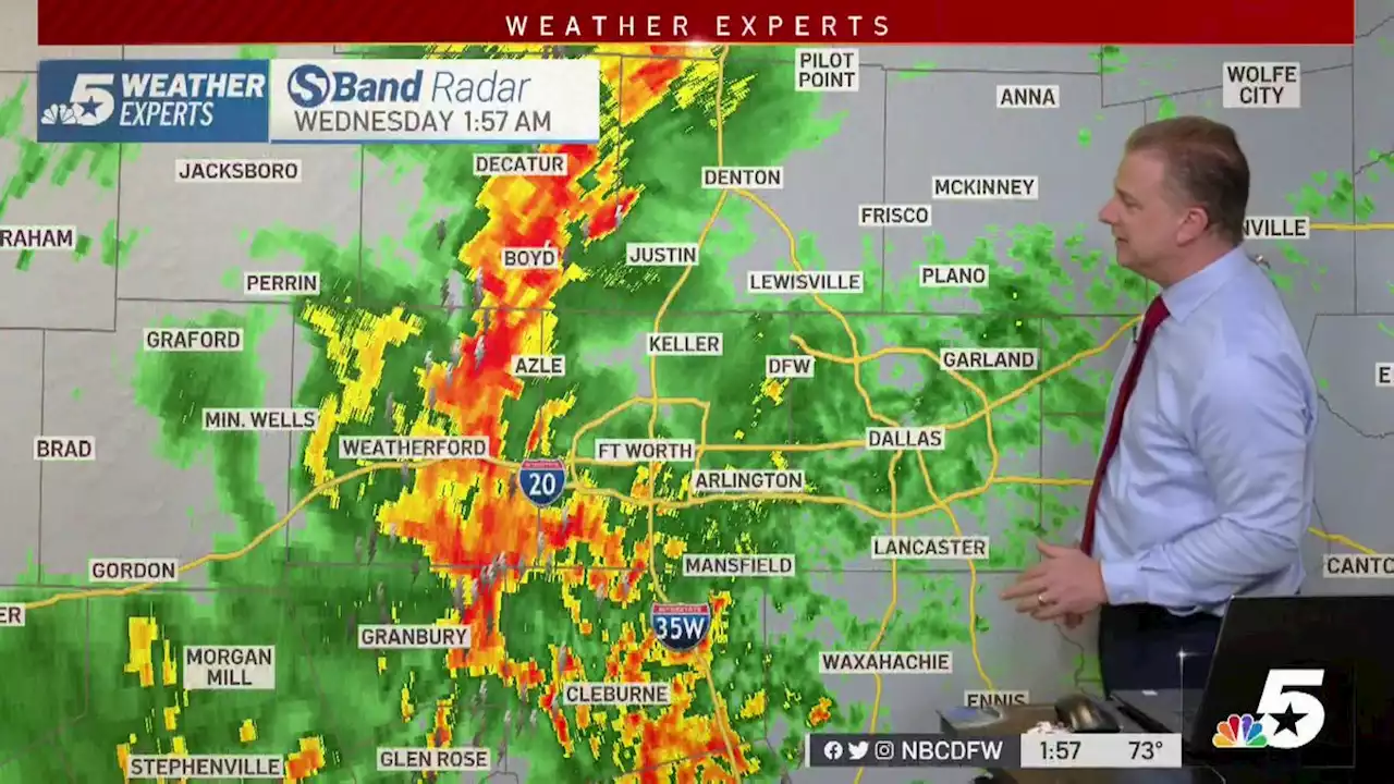 WATCH LIVE: Tornado Watch Issued as Sub-Severe Storms Bring Strong Winds & LightningWEATHER UPDATE: A Tornado Watch continues for much of North Texas as a line of strong storms marches east into DFW. We're tracking it live here:
Consulte Mais informação »
 Storms with high winds, lower tornado risk expected in North Texas overnightIt will be a stormy night in North Texas. Here's a look at when the storms will likely reach your house and how severe they might be.
Consulte Mais informação »