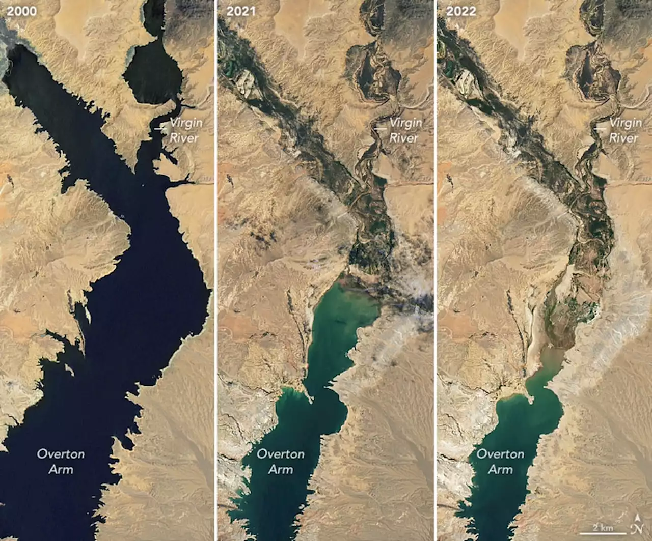
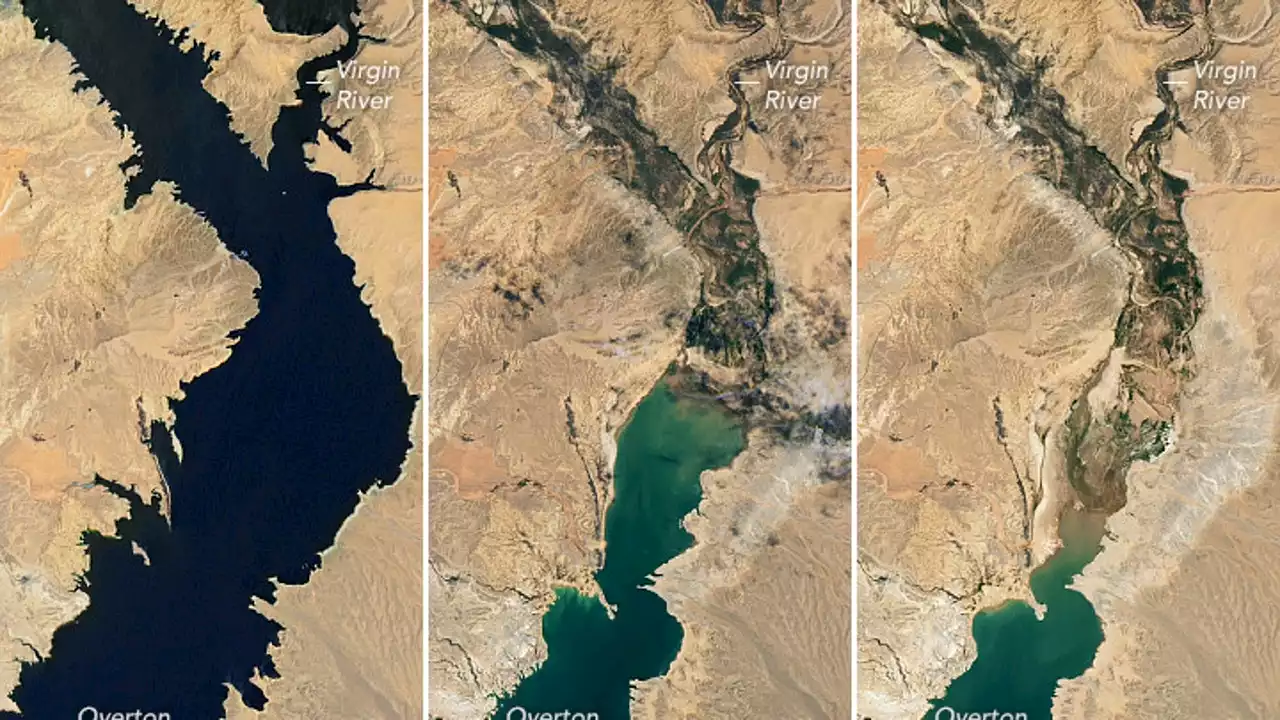
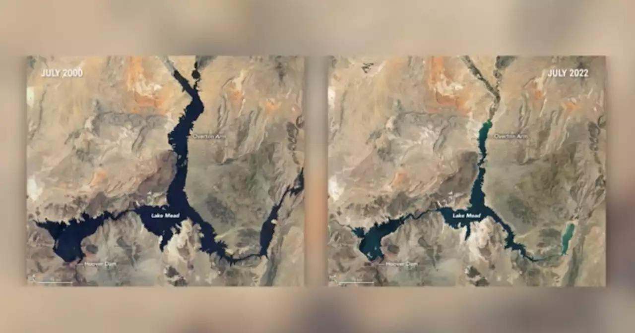
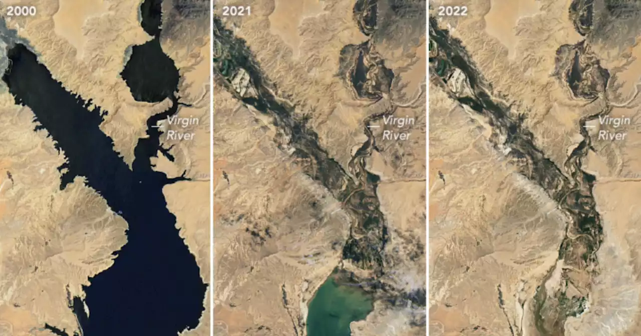
NASA has released new satellite images that show the rapid decline of water at Lake Mead since 2000.
, NASA noted that water levels at Lake Mead currently stand at the lowest since April 1937, when the reservoir was still being filled for the first time.Additionally, NASA said the water elevation at the Hoover Dam was 1,041.30 feet above sea level as of July 18; the water elevation at the end of July 2000 was 1,199.97 feet.
“Lake levels at the dam should stay above 1000 feet to continue operating hydropower turbines at normal levels,” NASA said.To read more, visit
Brasil Últimas Notícias, Brasil Manchetes
Similar News:Você também pode ler notícias semelhantes a esta que coletamos de outras fontes de notícias.
 NASA satellite images reveal Lake Mead's dramatic water loss since 2000Satellite images show Lake Mead's dramatic changes between 2000 and 2022, as its water level has reached its lowest point in more than 85 years.
Consulte Mais informação »
 NASA imagery shows Lake Mead water levels lowest in more than 80 yearsLake Mead is estimated to be at just 27% of capacity.
Consulte Mais informação »
 NASA Satellite Photos of Lake Mead 22 Years Apart Show Dramatic Water LossThe water levels are now at their lowest since 1937, when the lake was first being filled.
Consulte Mais informação »
 NASA releases Lake Mead images showing huge drop in water levels amid droughtSatellite images from NASA show a mineralized lakeshore that was underwater. Lake Mead is a huge water reservoir supplying water to seven states, Northern Mexico and tribal lands.
Consulte Mais informação »
 NASA Images of Shrinking Lake Mead Offer 'Stark Illustration' of Climate CrisisNew images of Lake Mead offer 'a stark illustration of climate change and a long-term drought that may be the worst in the U.S. west in 12 centuries.'
Consulte Mais informação »