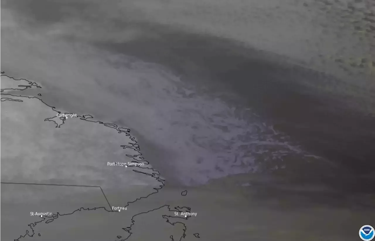
Yesterday, the GOESEast 🛰️ captured some 𝑐𝑜𝑜𝑙 imagery of ice eddies swirling in the Labrador Sea. Read more in today's ImageOfTheDay:
The swirling patterns resemble clouds at first glance, but they are actually chunks of sea ice caught in ocean currents along the coast. Often difficult to see from satellites, eddies can form along boundaries between cold and warm ocean currents due to differences in water density. Ice eddies, like those shown here, form when sea ice is caught up in the eddies.
The GOES East geostationary satellite, also known as GOES-16, keeps watch over most of North America, including the continental United States and Mexico, as well as Central and South America, the Caribbean, and the Atlantic Ocean to the west coast of Africa.